It's about diving. And cats.

Me diving

Sunday, September 27, 2020

Road Trip to "Idaho": A Non-Dive Trip

We were getting a bit restless having not traveled anywhere for 6 months, and I was very grumpy that my plans to go somewhere awesome for my birthday had been thwarted.  So we wanted to go somewhere, and since flying somewhere seemed like a bad idea, we decided it was a good chance for a road trip, and hence a good chance for a non-diving trip.  I somehow got the idea to go to Idaho.  I think I got the idea when I did a google search for road trips from California :) and started to zero in on some hiking and backpacking in the Sawtooth Mountains in Idaho.  Coincidentally, one of my coworkers went on a "bikepacking" trip to the Sawtooths a few weeks later, and when I saw his pictures, that sealed the deal.  So I spent quite a bit of time researching where to go and where to hike, and I even bought a paper map (quaint, huh?) of the trails around the area.  Then a couple of things happened.  I had a company event, so we had to delay the trip by a week, and the entire west coast went up in flames.  Well enough of it to make half of the country smokey anyway.  So by the time we were headed to Idaho, the air quality there was quite bad.  We devised a plan B of going to Utah, since it was still looking nice and green on the air quality map.

Oh, one extra interesting kink in the trip plan.  Rob recently got a Tesla.  So this makes long distance travel extra interesting to plan.  I was rather worried about ending up somewhere in the middle of nowhere, with a dead car and no charger in sight, and having to have the car towed to somewhere with a charger :P

Drive to Twin Falls, Idaho

Sun Valley, Idaho

Evanston, Wyoming

Red Castle Lake, Utah

Antelope Island and Salt Lake City, Utah

Alta, Utah

Back to Salt Lake City

Saturday, September 26, 2020

Road Trip: Back to Salt Lake City

After that, we headed back to Salt Lake City and checked into our hotel, the Hilton Salt Lake City Center.  We stayed at the Hilton this time because they have a Tesla destination charger, and because it's like one block closer to places you would go for dinner in Salt Lake City.  After lazing about for a bit, we decided to go for a walk to Temple Square and then up to the Utah state capitol.  The temple was undergoing some extreme construction, but we walked around the square and looked at some gardens, a statue of a sea gull, and talked to a few different young Mormon ladies, one of whom explained to us why there is a statue of a sea gull.  Rob tried to avoid talking to the Mormon ladies, but I think this is part of the experience with going to Temple Square.  After that we walked up to the capitol, looked very briefly at it (it was hot and sunny), and then headed back to the hotel, for more lazing about.

For dinner, we went to Market Street Grill, which is right next to Takashi, and which Rob had been to before.  It really reminded me of an east coast style seafood restaurant.  We had oysters and I had surf and turf.  And key lime pie.  Yum.

The next morning, we headed home.  It was a pretty uneventful drive.  We spent part of the really boring drive across Utah debating the merits of motorhomes, and looking at pictures of crazy luxury motorhomes online.  Turns out that while you can't watch Netflix on the Tesla while you are driving, you *can* search the internet.  Good to know.

Our last stop to charge was at Donner Summit, which was the biggest and most crowded supercharger that we saw on the entire trip.  It was in the parking lot of a shopping center with a grocery store.  We went into the grocery store to use the bathrooms, and it was without a doubt, the most crowded grocery store I'd been in since March.  I guess everyone is going to Tahoe, since they can't go on a real trip.

Thursday, September 24, 2020

Road Trip: Alta, Utah

We decided to do some car camping the next night.  We found some hiking spots that seemed worth hiking and not too hard :P around Alta, and the nearest camping spot that was open this late in the season was Tanners Flat Campground (in Sandy, UT).  The area is really close to Salt Lake City, so you could just go and do day hikes in the area, but we wanted to camp.  We stopped at a Target on the way out of town, to get provisions (marshmallows and graham crackers) and then headed to the campground.  It was first come, first serve so we drove around a bit and found a site right next to the creek.  We setup our tent (and moved it several times, until it was juuust right), got some fire wood, and lamented that we hadn't brought any food to grill (or charcoal to grill with) since there was a grill at our campsite.  Then we headed to Alta to hike to Cecret Lake, which looked like a nice easy hike.

The hike up is indeed pretty easy.  It gets steep and kind of rocky near the top, but it was fine.  Theere were some big smooth rocks in places, which would probably be annoying if it was at all wet.  Once we got up to the lake, we found a nice rock to sit on and hung out for a while, watching the little chipmunks dart around.  It started to get windy so we decided to head down.  But first we wanted to poke around a bit and see where the trail went if we continued to the left.  It seemed to continue.  So we followed that, and looking at a map, it looked like we could follow it a bit longer and eventually make our way back down a different route.  We figured in the worst case, we'd have to turn back and go back the way we came.  

This part of the trail was more in the woods and less rocky.  We were following our little dot on Rob's Avenza map (which showed trails that didn't exactly line up with the trail map I had, but were pretty close).  We had to make a few educated guesses of which way to go at Ts, and eventually it became clear we'd gone the wrong way, but we could see the trail that we thought we wanted to be on, to our left, down a big hill.  Rob tried to talk me into climbing (sliding?) down the big hill and I refused and insisted we return to the last T and go the other way.  You can imagine how Rob felt about that.  So for most of the rest of the hike down, Rob was annoyed at me, but well, we found our way down without a hitch once we got back to that T.  From the map in the Apple Fitness app and the AllTrails map, it's pretty obvious where we went wrong.  Though you can also see that if we had kept going, we would have eventually come to another T where we could have made it down.  By the way, I liked the path that we took down, and would recommend doing the hike as a loop (which also makes it a longer, slightly more respectable hike).

On the way back to our camp site, we stopped at the little grocery store at Snowbird, hoping to find beer/wine and/or some food for dinner that would be better than a dehydrated meal.  We struck out on food (due to our lack of charcoal) but we did manage to each find a can of beer to our liking.

After that, we headed back to our camp site and checked our the creek/stream next to it.  There were some little waterfalls along the stream, which Rob attempted to take pictures of.  The fact that neither he nor his camera ended up in the stream is a small miracle.

For dinner, we made a little noodle appetizer (using our amazing discovery that ramen plus cold water makes an awesome noodle dish) to go with our beers and then we had dehydrated chicken and dumplings for the main event.  This time we managed to get boiling water from our burner, which made the chicken and dumplings significantly tastier.  We built a fire and sat around it for a while, making s'mores and nursing our beers.  Yum.

The next morning, we packed up our camp site, and headed to Gloria Falls for a hike.  By the time we got there, a little before 9am, the parking lot was full and we had to park on the road, kind of a ways away from the trailhead.  Oh well.  So the hike to Gloria Falls is about a mile and a half.  After an initial not too long flat section, it's a pretty steady uphill (but not too uphill) walk.  It's an easy, civilized trail.  Right near the very end, there are some steep sections that require a bit of thought to decide which way to go.  I think it's highly likely we were technically off-trail at that point, though, since on the way down, we found a less steep path down in that area.

Anyhoo, I got ahead of myself.  The most important thing to know about this hike is that on the way up, in a meadow (or something) off to the right of the trail, we saw two moose!  Yay!  Unfortunately neither of them had antlers.  Very disappointing.

When we got to the waterfall, it was quite obvious that we were at the waterfall; I say that only because there were a couple of tiny waterfalls that we saw on the way, where we were like "is this the waterfall?".  And they were not.  Also, when we got to the waterfall, omigod were there a lot of screaming kids.  It was kind of intense.  There was basically no way to get a picture of the whole waterfall without a lot of people in the frame.  But the waterfall consisted of many small cascades, so Rob managed to get some shots of parts of the waterfall, without any screaming kids in the frame.  We were there for maybe 20 or 30 minutes and then headed back down.

From there, we were headed back to Salt Lake City (eventually) but we wanted to get lunch (late breakfast) first.  Fancy-pants Rob suggested we go Park City, since he'd been there (for dinner, I think) before.  We went to The Bridge, where I had a very tasty breakfast burrito.

Wednesday, September 23, 2020

Road Trip: Antelope Island and Salt Lake City, Utah

The next morning we headed to Salt Lake City.  On the way out of Evanston, we stopped at a great breakfast place called Jody's.  It was my ideal kind of breakfast place; there was a folksy mural on the wall, and they had biscuits and gravy on the menu.  Even better, you could substitute the toast option on any meal with a 1/2 order of biscuits and gravy -- which is the perfect amount of biscuits and gravy, in my book.  They also had corned beef hash and eggs, which is Rob's favorite.  After we loaded up on calories, we headed to Antelope Island.

Antelope Island is the biggest island in the Great Salt Lake.  I'd never been to Salt Lake City or seen the Great Salt Lake, so it seemed like a cool place to check out.  Aside from the pronghorn antelope for which it is named, the island is fabled to have several other kinds of interesting wildlife, including bison.  Well pronghorn and bison were the only wildlife that we saw.  We saw lots of bison and a few pronghorn.  We drove around the island, looking for wildlife, and occasionally stopping to get out (mostly to take pictures of said wildlife).  It was pretty hot and sunny when we were there, so hiking was definitely not an option.  

There is a beach on the north end of the island, and I wanted to wade into the Great Salt Lake, so we walked down to the water to do that.  It's a pretty long walk down to the water (maybe 10 minutes) and well, to be honest, it was a bit anti-climactic.  I tasted the water, and it was very salty.  I think we drove around all of the island that could be driven around, some of it multiple times, and it was still only a couple hour activity.  So worth going to if you are in Salt Lake City, but not amazing.

After that, we headed to Salt Lake City.  The nice thing about Salt Lake City is it has actual hotels.  Like the kinds of places that you might actually stay at even if you weren't on a grubby road trip.  So that was nice.  After much deliberation (because there are so many hotels and they were all so cheap), we decided to stay at a Marriott that Rob thought he'd stayed at before.  Everything was super deserted and the hotel bar was closed.  But the Starbucks in the lobby was open, phew.  The other great thing about Salt Lake City is they have real restaurants, that you can look up on OpenTable and make reservations at.  Since Rob has been to Salt Lake City a bunch of times for work, he actually knew some places that he suggested we go.  He suggested a sushi place for dinner (Takashi).  I was super suspicious of the concept of sushi in Utah, but he swore it was a trendy sushi place that I'd like.  Takashi was actually closed (due to COVID) but the bar right next to it (Post Office Place) was open and was serving both of their menus.  So it was even trendier than expected.  But it was awesome.  Tasty drinks, tasty sushi.  Mmmm.

Later in the evening, after recovering from the sushi and drinks, we went to Penguin Brothers, this very cute pink ice cream sandwich shoppe (with a "pe" at the end).  We went there, got our ice cream to go, and then headed to a Supercharger for a charge.  I got the s'mores ice cream on chocolate cookies.  The ice cream was *amazing*.  It was graham cracker ice cream with marshmallows and chocolate in it, which is like a million times more interesting than a chocolate-based s'more ice cream.  I'm sad to report that I didn't get a picture of my awesome ice cream :(  I've been contemplating an attempt at graham cracker ice cream ever since.

Tuesday, September 22, 2020

Road Trip: Red Castle Lake

Our hike began at the China Meadows Trailhead, which was, according to Google, about an hour and a half from Evanston.  We wanted to be there by 9, so we left the hotel at 7:30.  Rob punched the location into his navigation system and it confirmed that it was about an hour and a half away.  Over an hour later, after we were well onto a dirt road that was getting more and more dirt-like and less and less road-like, and as the ETA got later and later, I discovered that his navigation system had routed us differently than google.  Hmmm.  I punched it into google, and it said that at this point there was like a one minute difference between turning back and continuing on the route the car had chosen for us.  So we kept going.  That was a big mistake.  

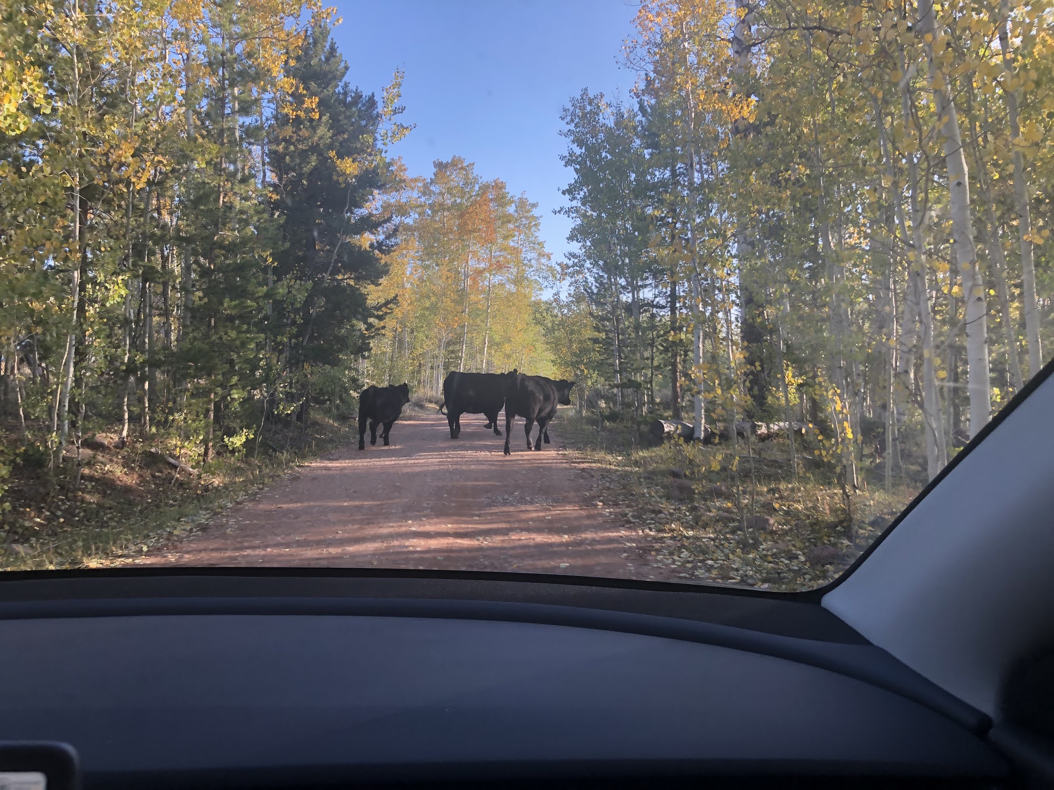
Soon we crossed into national forest land, and encountered cows along the side of the road.  It was pretty deserted, but we occasionally passed a pickup truck with a trailer off of the road.  I think people were camping there to hunt.  Then the road deteriorated to the point that the meadow alongside of us looked like a better route than the road;  and there were quite a few tire tracks through the meadow.  So we left the road and drove through the meadow, until the road became more passable.  Shortly after we returned to the road, there was a short section that was VERY rocky and went steeply up.  I was not sure we could make it up it, and less sure what we would find once we did make it up.  Rob got out and walked up to the top and decided we probably could make it up but wasn't sure what was yet to come.  So at this point, we decided to turn back.  

Rob was pretty annoyed (at me?) and was sure that we wouldn't be able to make the hike today, at all.  By my calculation, we would still make it to the trailhead by 10, and with an approximately 5 hour hike, I thought this was fine.  I was a bit worried about the car having enough charge to get us to the trailhead and then back to Evanston at the end of the trip.  We headed back and figured we would come up with a "rock bottom" charge for the car when we got to the correct turnoff (the one that Google recommends, and that the Forest Service recommends :P).  That turn puts you on a road that the forest service refers to as an "oil and gravel road".  I wasn't sure what that was, but it sounded better than driving through a meadow.  The road was bumpy and got bumpier but other than that, it was just fine.  We managed to get to the trailhead with a few percent more battery left than our rock bottom (and the last 30 minutes were uphill, so I figured the drive out would be easy) a few minutes before 10:00.  Phew.

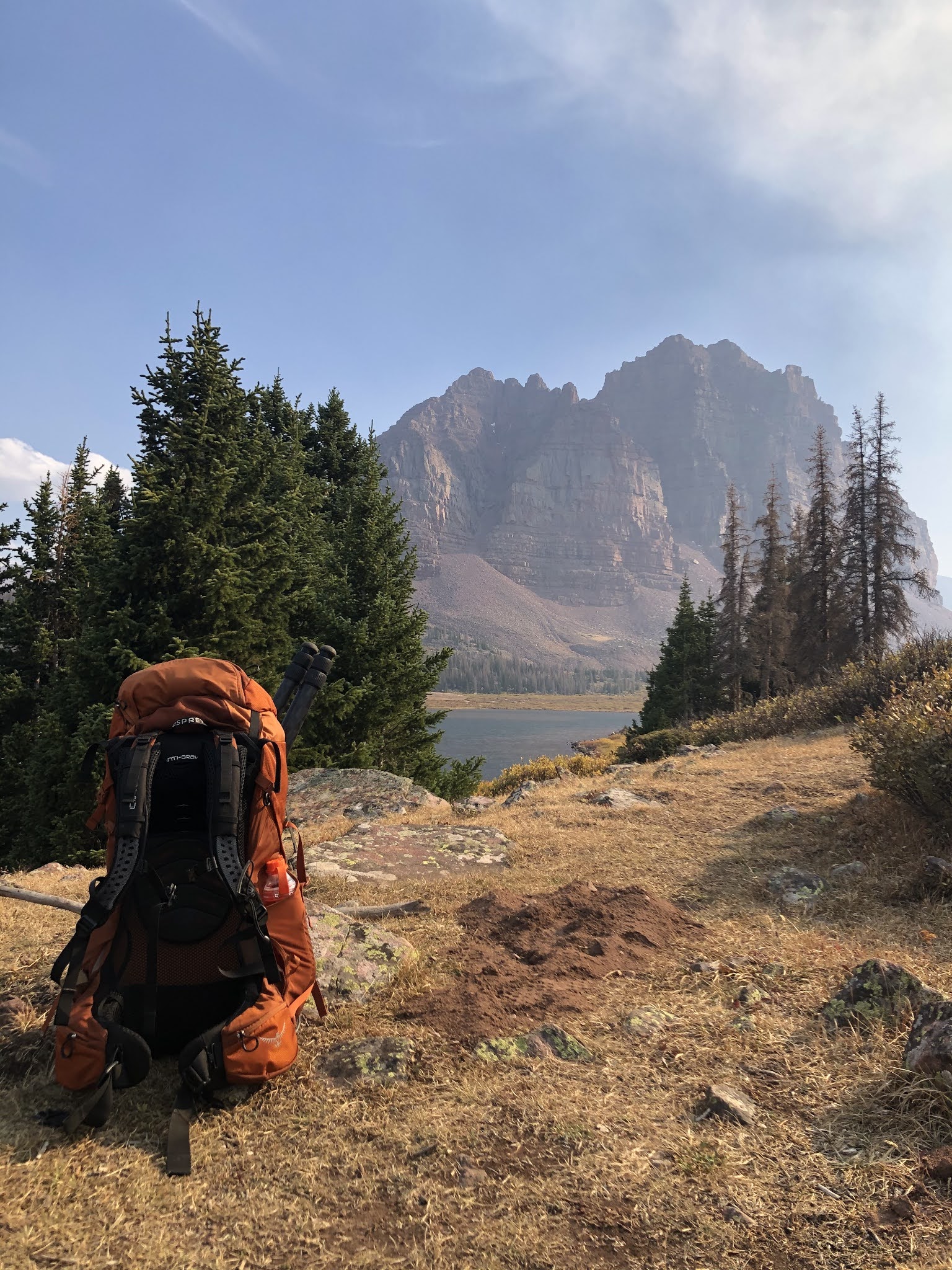
Based on what I'd read, the route was somewhere between 9 and 12 miles (with 10 miles seeming most likely) with about 1500 ft of elevation gain.  But it starts at nearly 9000 feet, which I found difficult.  The trail is very well maintained.  There are many points where you have to walk across small streams or muddy areas, but they all had nice rock trails across them.  There were one or two crossings that I found tricky, but I am generally a very big wimp about balancing myself on rocks.  The first 8 o 8.5 miles slope up very gradually, at most 100 feet per mile, and then there is a one mile section of switchbacks where you probably cover like 500 feet.  The switchbacks were a bit exhausting (especially at that altitude and that far into the hike) but nicely maintained and overall very civilized :)   I found the hike to be very tiring (due to the altitude, I think) and my feet were killing me (I really need new hiking boots -- any serious hike results in a HUGE blister on one of my heels -- like 2 inches in diameter!) but I would not describe it as "hard".  But I did just want to get the hell out of my pack by the time we got to the lake :P  Rob's legs were destroyed about 6 or 7 miles in; I think his pack was too heavy due to his camera gear.  We probably should have load balanced better.  At some point I looked back and saw that Rob had acquired a walking stick.  It was a very nice-looking, sturdy stick.  I'm not sure Rob would have made it the rest of the hike without his stick to lean on :P

A lot of the hike was along a stream, and most of it was shady.  There seem to be differing opinions on the level of shade in the reviews that I've read.  There are sections out of the shade but they didn't seem to last longer than 5 or 10 minutes.  It was probably low 50s when we left and high 50s by the hottest part of the day, so the weather was perfect for being able to wear a lightweight long-sleeve shirt and not have to worry about sunburn.

Anyway, a couple of useful tips for the hike.  

- If you don't want to do the whole hike in in one day, there is an area about 7 miles in right near a bridge that goes over the stream (creek? river?) which has good access to water and lots of flat spots that look like good places to pitch a tent.  

- A little before mile 10, we came to a fork in the trail, with a sign that pointed right to go to Lower Red Castle Lake, which we followed.  But going left is better.  From the path that we took, we could see the lake but couldn't see how to get over to it until we saw some tents and basically brute forced our way through a bunch of bushes to our left to get over to where we saw campers.  Those campers were very friendly and pointed us to a really good camp site.  After setting up camp and wandering around, we found the trail that we should have come in on (and that we hiked out on), which was the trail at the left of that fork.  If we had taken that route, it would have been another 0.75 miles and we would have been led right past some great camp sites.

- The total hike was around 10.5 miles, according to my Apple watch.  It took us about 6 hours, which included many stops for snacks and whining.

- We saw TONS of people hiking out on our way in.  But when we got to the lake, there were only 2 other groups (one near us, one far away) camping there.  I assume this is because we went up there on a Sunday and on the weekend it's more crowded.

We were both pretty destroyed when we got to the lake.  Rob claims we were "delirious" hehehe.  I mostly just wanted to get out of my damn boots (and pack).  So it was a very lazy evening, once we had our tent set up and had filtered water from the lake.  I managed to produce a pretty nice cheese plate to snack on (I was in charge of provisioning and I was quite excited about the manchego and salami that I had brought!).  Rob wanted to shoot sunset, so by the time we were making dinner, it was cold and getting dark.  We couldn't manage to get our water quite to boiling for dinner, so we had lukewarm, not quite rehydrated chicken and dumplings.  It was more like chicken and croutons, which was still tasty :)  In hindsight, due to our delirium and exhaustion, we did not really eat enough.

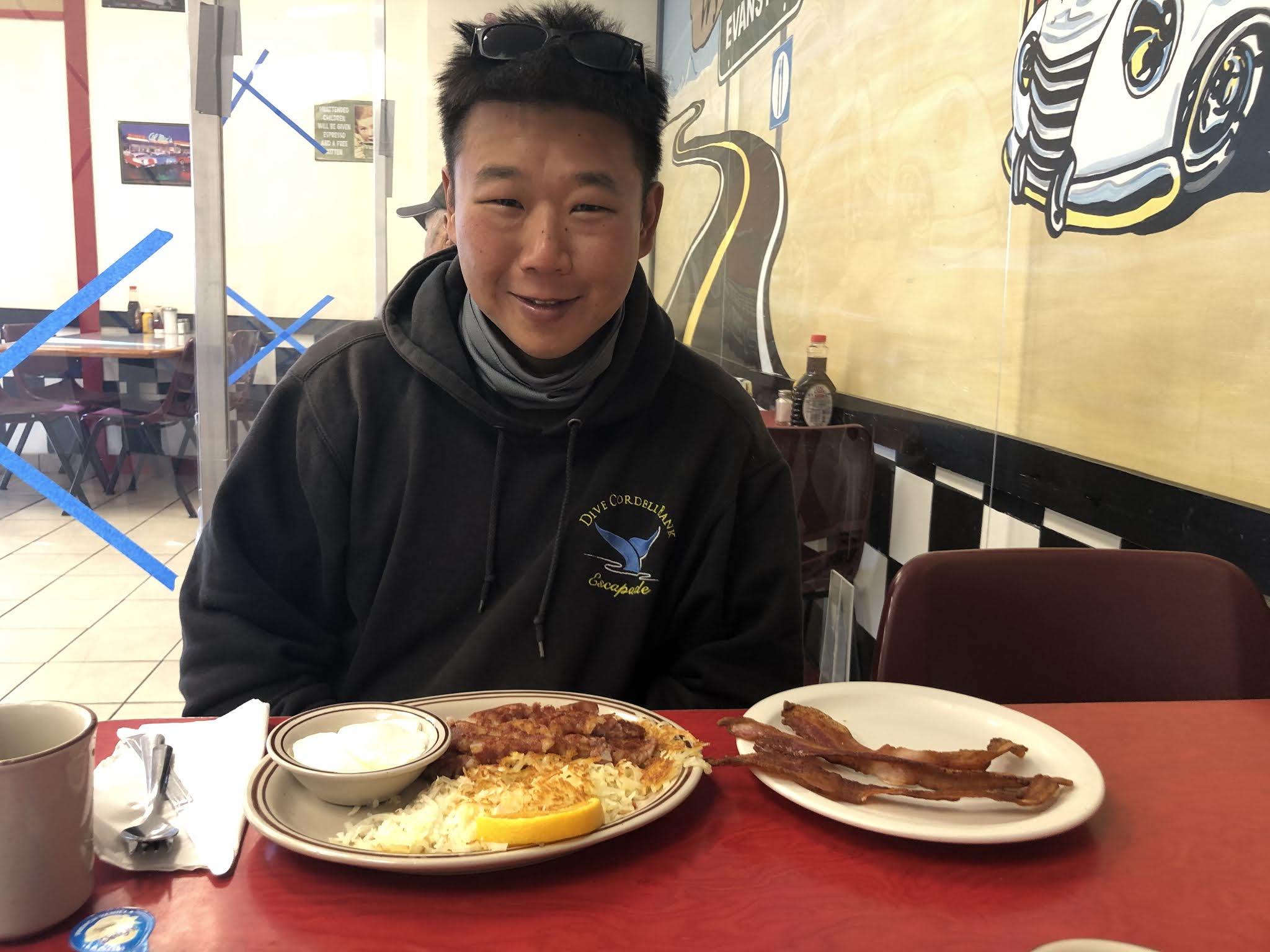
Our plan for the second day was to hike up to Red Castle Lake (we were staying at Lower Red Castle Lake).  Details were once again sketchy in terms of how far it was, but it seemed likely to be 2.5 to 3 miles away.  We were exhausted and weren't convinced we were actually going to do it.  We talked about just walking around our lake and laying around in the tent for the day :)  Then our neighbors (who had packed up and were about the leave) told us we should really go up to the next lake, that it was only like a mile and a half, and there were moose at sunset.  Those two facts changed our mind about going there.  As we were chatting, one of the guys looked at Rob's sweatshirt and said "you dove Cordell Bank?".  Turns out he was from the bay area, dives in Monterey, and was familiar with Cordell.  Small world.


Since we were having trouble getting super hot water (our oatmeal that morning was a bit lukewarm, but the coffee was just right), I mentioned to Rob that you can make ramen (or most dehydrated meals) with not-hot water, it just takes much longer, and obviously results in not-hot food.  We decided that not-hot ramen noodles might actually be good, so after breakfast, we put a pack of ramen noodles in our pot with not-hot water and figured we'd see what that produced by lunch time.

We went for a short walk down to the lake and around it (to the left).  We found the perfect little rock for two people to sit on at the edge of the water and hung out there for a while.  We debated whether the nearest camp site was a better camp site than ours, but we had some pretty good sitting rocks at our site, just not right on the lake.

When we returned to camp, we found that the ramen noodles had plumped up quite a bit and were delicious.  In fact, I think they are more delicious like that than as soup.  After lunch, we came up with a plan for hiking up to the other lake.  We figured we wanted to be there an hour before sunset, then we estimated how long it would take to get there, and then we added an hour, so we could walk as slowly as we wanted :)  This turned out to be a good idea, not just because we walked slowly, but also because the sun sort of set behind the "castle" rock before it was actually sunset.  So "an hour before sunset" is more like two hours before sunset.  This is good because it means you can have a cheese plate and walk slowly back down without worrying about hiking in the dark.

The hike up was indeed pretty easy.  There were some annoying sections where you are walking over ankle-turner rocks, and some small stream crossings, but there was nothing hard either technically or in terms of exertion.  It did seem like we were almost there for quite some time, and just when you think you are almost there, you come to a clearing that after walking across, you have to walk up a short steep section (though it's almost like walking up stairs, so not difficult, just tiring).  Then there is a long walk to actually get to the water.  I think it was around 2 miles.  But it's better that we thought it was 1.5 :)

On the way up, we were walking through a nice forested area (probably the nicest part of the walk) and I saw a moose in the forest!  It didn't have antlers, so that was a bit disappointing, but it was a moose!  Rob did not have time or the right lens to get a real picture, but we got a "proof of moose" picture.  I'd never seen a moose before, so that made the whole hike worth it!  Anyway, once at the lake, Rob was taking pictures for a while, so I took some pictures of him taking pictures.  Then when I got bored of that, I found a nice sitting rock, and made us a cheese plate.  It was a pretty awesome cheese plate for being 12.5 miles from civilization.  Well 12.5 miles from the car, civilization was way further than that.  After the sun had deposited itself behind the castle, we headed back down to camp.

On the second night, we were much more organized about dinner (okay, I was much more organized, and Rob followed orders).  We had dinner before Rob's evening photography plans kicked off.  I really wanted to have late night hot chocolate (and oreos) but didn't want to have to schlep back to our bear bag late at night.  So after dinner (rehydrated beef stroganoff, this time made with boiling hot water), we put boiling hot water in a thermos, hot chocolate powder in our mugs, and oreos in a bowl.  Then we packed up all of our trash and food and hung the bear bag.  Then after Rob's photo fun, we listened to a couple of podcasts in the tent and had hot chocolate and oreos.  And we just had to clean up our dishes before going to bed.  Rob set an alarm for 11 or 12 to do some photo things.  I didn't really know what he was doing, but he said it would only take 10 minutes to setup and then he would go back to bed.  So I got up with him so I could see the stars and milky way (which was very visible to the naked eye).  It was not nearly as cold as it had been the night before.  After Rob doinked with his camera for a bit, we went back to bed.

I woke up a couple hours later and heard something in the vestibule (where our backpacks were).  It sounded like something scratching at either the tent or our bags.  I'm sure it was some sort of rodent.  I listened for a while and then woke Rob up.  He tried to scare whatever it was away basically by punching at the side of the tent, and that seemed to work.  Not that much later, I woke up to what I thought was really bad wind.  It was very noisy in the tent (but perfectly warm).  Rob woke up and hopped up out of the tent and took off.  I wasn't sure why.  Then I figured he was worried about his camera blowing into the lake.  It seemed like he was gone for a while, and when he came back, he stuck his camera in the tent.  I asked if he was worried about the tripod blowing away.  Apparently it wasn't actually wind that I was hearing, but rain.  It had just started to rain, so the camera was okay.  Unfortunately the doinking Rob had done earlier in the evening was to setup a long exposure shot to start 3 hours later, and it had not quite made it to that time when he had to pull the camera inside.  After Rob got back into the tent, it started to really pour.  Or that's how it sounded in the tent.  It was not that wet the next morning, so perhaps the tent just magnified the sound.

The next morning, Rob took some early morning pictures, we had breakfast (reasonably hot oatmeal and coffee) and packed up to hike out.  The hike out was reasonably pleasant.  My toes were still killing me from the hike in, so that was kind of unpleasant, but well, it was all downhill, so there was a lot less complaining.  The hike out was not substantially faster than the hike in -- I think it took about 5 and a half hours.  We took a 5 minute break every hour for the first 3 hours.  Then my watch died, which meant that I could no longer pace our breaks and had to keep asking Rob for time/distance.  As you can possibly imagine, Rob was not too amused by that :P

I was quite delighted when I saw the car, because it meant that I could change into flip flops :)  We headed back to Evanston (with plenty of charge) and we were so hungry.  I had been thinking we would stop for lunch on the hike out, but we ended up just consuming all of our trail snacks (nuts, trail mix, dried mangoes).  Since we were in Wyoming, and we had encountered so many grazing cows, we decided we should find some steaks for dinner.  A bit of research revealed one supposedly good steak place in town, but we couldn't get a reservation until late enough in the evening that I surely would have gnawed my arm off before then.  So instead, we went to Cattle Company Steakhouse.  It's attached to a motel, and not a very impressive looking place, but the steaks were VERY tasty and so were the sweet potato fries.  They may have been the best sweet potato fries I've ever had.


Saturday, September 19, 2020

Road Trip: Evanston, WY

Waiting to charge
We had done a little bit of research on backup options if it was too smoky in Idaho, and based on that plus the weather/air quality forecast for the next few days, we decided to do a 3 day/2 night backpacking trip in the High Uinta Wilderness to Red Castle Lake.  We decided that the most reasonable place to stay the night before was beautiful Evanston, Wyoming.  There's a supercharger there and some reasonable hotels to stay at.  We stayed at the Hampton Inn, which quite conveniently has a super charger in its parking lot (though we didn't realize that when we picked it -- I picked it based on my perception of its price-performance).

Red monkey butt amber ale


We had a night to kill in Evanston, and after a bit of research, we decided to go to Suds Brothers Brewery.  If nothing else, it would give me a good opportunity to continue documenting our trip in Untappd (which I'd been doing a pretty good job of so far).  I gave the Red Monkey Butt Amber Ale a 3.5.  They had fried cheese curds on the menu; Rob was not familiar with the concept of cheese curds (except in poutine form), so we had to give those a try :)  A couple of other observations on our short time in Evanston -- there are a lot of big pickups everywhere that you go (I was jealous) and wearing masks didn't seem to be a thing that had spread to these parts.  When we walked into the restaurant, everyone was looking at us like we were aliens, and I think that is why.

When we got back to our hotel, we packed our backpacks.  Somehow, I ended up with a really light (but full) backpack after our first attempt, so we ended up trading a few puffy lightweight items (like my coat) for heavier items (cheese and sausage) to try to make up the difference.  Eventually I decided not to complain anymore about my pack being too light :)


Friday, September 18, 2020

Road Trip: Twin Falls to Sun Valley, ID

On Friday, our plan was to charge the car (and find some coffee), check out Shoshone Falls and the Snake River Canyon, then head to Sun Valley and stop at Craters of the Moon National Monument on the way there.  We drove over to the supercharger and realized it was in the same parking lot as the Twin Falls visitor center, which was overlooking the Snake River Canyon right next to the Perrine Bridge.  Convenient.  So we walked across the street to Starbucks and when we came back, we went over to look at the canyon and noticed people setting up on the little lawn next to us to BASE jump off of the bridge over the canyon.  I was a bit astonished that this was allowed.  But people would basically non-stop jumping off of the bridge.  According to its Wikipedia page, the bridge "may be the only man-made structure in the United States where BASE jumping is allowed year-round without a permit".  The lawn next to the bridge was like the Breakwater of BASE jumping :)

Shoshone Falls (we suck at selfies)
After watching a bunch of the jumpers, we decided to head over to Shoshone Falls.  You can drive right up to an overlook to see the falls, and then there's a path on the other side of the canyon that you can walk up (and up and up) to get a different/less crowded view.  It was a nice little meander.  We walked for less than a mile before turning back, so it's really not much of a commitment to go on the walk.  There are some pretty cool-looking houses at the top of the cliff, overlooking the falls.

Inferno Cone
After that, we headed out of town toward Craters of the Moon.  I'm a bit divided on whether it was worth going there.  If you've seen lava fields before, I'm not really sure it's worth the drive.  On the other hand, if we had skipped it and gone straight to Sun Valley, I don't know if there would have been enough of the day to do much.  Craters of the Moon is a good stop if you want to drive around, get out of the car and walk around a little bit, then get back in the car and drive to the next point.  After the very uphill meander by the falls, it was a nice lazy afternoon.  We stopped in a few spots at Craters of the Moon to walk around.  I think the most interesting (and tiring) of the bunch was the Inferno Cone.  It's basically a huge volcanic ash sand dune that you can walk up.  Pretty neat.

Rob in Ketchum
When we got to Sun Valley, it was still very hazy out.  It didn't smell smoky like it had in Twin Falls, but the smoke was definitely impacting visibility.  We stayed in Sun Valley, which is outlandishly expensive, because they have Tesla destination chargers.  There's no public supercharger around here; this was the one part of the trip where charging was a pain.  (Even with the destination charger, it was a pretty big pain, since you have to happen upon the charger when no one is using it, and hope that someone doesn't leave their car plugged in all night even though it's finished charging.)

Pig whistles and poutine


We went to Ketchum for dinner.  Ketchum is a cute little town.  Even though it's a ski resort town, it feels like a real town and not a fake ski resort town (like Vail does, in my opinion).  We went to the Warfield Distillery and Brewery for dinner.  We sat on the roof deck, and hoped that it wouldn't start raining before we finished.  We shared Pig Whistles (most amazing snack ever), poutine, and brisket.  Everything was super tasty.  When we got back to the car, we noticed that the public EV charger right near where we parked was open, so we decided to plug in for a bit and go find a drink somewhere.  Finding a drink was harder than expected, because now it was 7pm on a Saturday night, and everything was busy.  

Ketchum Kolsch
We ended up back at Warfield, where we got more beer.  After killing time there for a while, we decided to get ice cream.  There was an ice cream hut that we'd passed on the way from where we parked -- Leroy's Ice Cream.  I got the Elk Tracks, because I can't pass up an ice cream flavor named after wild animals (e.g. Moose Tracks or Maine Black Bear at Cabot's).  Just as we were getting our ice cream, it finally started to rain, so we had to trot back to the car in the rain.  We ate our ice cream in the car while watching Netflix and waiting for a bit more charge.

It rained overnight, so in the morning, it was a bit less hazy out.  However, the forecast was for the air quality to get a lot worse over the next few days.  So we decided to do a hike near Sun Valley and then head to Utah for the rest of the trip.  After a bit of research, we settled on Taylor Canyon for the hike.  We did the loop counterclockwise, which I think was wise.  Much of the hike up was under tree cover, whereas the entire hike down was exposed.  Anyway, it was a nice reasonably short hike.  It was reasonably steep most of the way up and at the steepest part I think I was stopping for a break like every minute :P  But it was a nice trail and overall not very difficult.  When we got to the top, we took some pictures, even though Rob was sort of grumpy because it was still hazy.


On the way down, some sort of strange frozen precipitation started to fall on us.  It was 56 degrees and sunny when this started.  I thought it was hail at first, but when the little frozen balls landed on my shirt, I could squish them and they would collapse into a little pile of snow, like a tiny snowball.  After some extensive (okay not that extensive) internet sleuthing, I think that this was graupel, which I have literally never heard of before.  I'm still not convinced it's a real thing, since Blogger puts a squiggly red line under the word ;)  There was intermittent rain too on the way down, but it was just a few big drops for a minute and then it would stop for a while.  It was pretty refreshing considering we were totally exposed to the sun on the way down.

After the hike, we headed out of town, toward Utah. 

Thursday, September 17, 2020

Road Trip: The Drive to Twin Falls, Idaho

Birthday lunch
We left on Thursday morning, after my big "company event" which I had amazingly managed to survive un-hungover, and got going around 9AM, not sure if we were going to drive to Idaho or Utah :)  The air quality was terrible once we got to the Tahoe area.  It was also quite hot.  We stopped in Reno for our second charger stop and it was hot, humid, grey, and smelled like a camp fire.  The supercharger we used was a block from a fast food Korean place, so we walked over there and got some spicy pork bibimbap to eat in the car while we watched the West Wing (my favorite TV show of all time).  It was so tasty, just writing about it now is making me hungry.

On the topic of the West Wing... Rob gets pretty sleep when he has to drive long distances, so I thought that listening to some podcasts or books on tape might be a good way to keep him "engaged".  We were listening to an episode of 99% Invisible (one of the podcasts that Rob listens to), and I was googling around looking for some other good podcasts and I found something amazing -- the West Wing Weekly.  It's a podcast about the West Wing.  Each episode talks about an episode of the show.  One of the hosts is Joshua Malina, so they actually have access to interesting guests from the show.

Birthday dinner
Somewhere in the middle of Nevada, we started to seriously consider going to Utah.  Rob called a couple of his coworkers from Utah to get some advice on where to go if we wanted to go there.  But after waffling and staring at the air quality app on my phone, we decided to give Idaho a try.  We stopped in beautiful Elko, Nevada for our final charge stop and dinner at Mattie's Taphouse and Grill.  It was pretty decent for a restaurant in a random strip mall off of the interstate :P

After not too much longer of a drive, we got to Twin Falls, Idaho, where we were staying for the night (at the beautiful Twin Falls Fairfield Inn).