The hike up is indeed pretty easy. It gets steep and kind of rocky near the top, but it was fine. Theere were some big smooth rocks in places, which would probably be annoying if it was at all wet. Once we got up to the lake, we found a nice rock to sit on and hung out for a while, watching the little chipmunks dart around. It started to get windy so we decided to head down. But first we wanted to poke around a bit and see where the trail went if we continued to the left. It seemed to continue. So we followed that, and looking at a map, it looked like we could follow it a bit longer and eventually make our way back down a different route. We figured in the worst case, we'd have to turn back and go back the way we came.
This part of the trail was more in the woods and less rocky. We were following our little dot on Rob's Avenza map (which showed trails that didn't exactly line up with the trail map I had, but were pretty close). We had to make a few educated guesses of which way to go at Ts, and eventually it became clear we'd gone the wrong way, but we could see the trail that we thought we wanted to be on, to our left, down a big hill. Rob tried to talk me into climbing (sliding?) down the big hill and I refused and insisted we return to the last T and go the other way. You can imagine how Rob felt about that. So for most of the rest of the hike down, Rob was annoyed at me, but well, we found our way down without a hitch once we got back to that T. From the map in the Apple Fitness app and the AllTrails map, it's pretty obvious where we went wrong. Though you can also see that if we had kept going, we would have eventually come to another T where we could have made it down. By the way, I liked the path that we took down, and would recommend doing the hike as a loop (which also makes it a longer, slightly more respectable hike).
On the way back to our camp site, we stopped at the little grocery store at Snowbird, hoping to find beer/wine and/or some food for dinner that would be better than a dehydrated meal. We struck out on food (due to our lack of charcoal) but we did manage to each find a can of beer to our liking.
After that, we headed back to our camp site and checked our the creek/stream next to it. There were some little waterfalls along the stream, which Rob attempted to take pictures of. The fact that neither he nor his camera ended up in the stream is a small miracle.
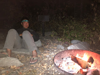
For dinner, we made a little noodle appetizer (using our amazing discovery that ramen plus cold water makes an awesome noodle dish) to go with our beers and then we had dehydrated chicken and dumplings for the main event. This time we managed to get boiling water from our burner, which made the chicken and dumplings significantly tastier. We built a fire and sat around it for a while, making s'mores and nursing our beers. Yum.
The next morning, we packed up our camp site, and headed to Gloria Falls for a hike. By the time we got there, a little before 9am, the parking lot was full and we had to park on the road, kind of a ways away from the trailhead. Oh well. So the hike to Gloria Falls is about a mile and a half. After an initial not too long flat section, it's a pretty steady uphill (but not too uphill) walk. It's an easy, civilized trail. Right near the very end, there are some steep sections that require a bit of thought to decide which way to go. I think it's highly likely we were technically off-trail at that point, though, since on the way down, we found a less steep path down in that area.
Anyhoo, I got ahead of myself. The most important thing to know about this hike is that on the way up, in a meadow (or something) off to the right of the trail, we saw two moose! Yay! Unfortunately neither of them had antlers. Very disappointing.
When we got to the waterfall, it was quite obvious that we were at the waterfall; I say that only because there were a couple of tiny waterfalls that we saw on the way, where we were like "is this the waterfall?". And they were not. Also, when we got to the waterfall, omigod were there a lot of screaming kids. It was kind of intense. There was basically no way to get a picture of the whole waterfall without a lot of people in the frame. But the waterfall consisted of many small cascades, so Rob managed to get some shots of parts of the waterfall, without any screaming kids in the frame. We were there for maybe 20 or 30 minutes and then headed back down.
From there, we were headed back to Salt Lake City (eventually) but we wanted to get lunch (late breakfast) first. Fancy-pants Rob suggested we go Park City, since he'd been there (for dinner, I think) before. We went to The Bridge, where I had a very tasty breakfast burrito.


No comments:
Post a Comment