It's about diving. And cats.

Me diving

Tuesday, September 22, 2020

Road Trip: Red Castle Lake

Our hike began at the China Meadows Trailhead, which was, according to Google, about an hour and a half from Evanston.  We wanted to be there by 9, so we left the hotel at 7:30.  Rob punched the location into his navigation system and it confirmed that it was about an hour and a half away.  Over an hour later, after we were well onto a dirt road that was getting more and more dirt-like and less and less road-like, and as the ETA got later and later, I discovered that his navigation system had routed us differently than google.  Hmmm.  I punched it into google, and it said that at this point there was like a one minute difference between turning back and continuing on the route the car had chosen for us.  So we kept going.  That was a big mistake.  

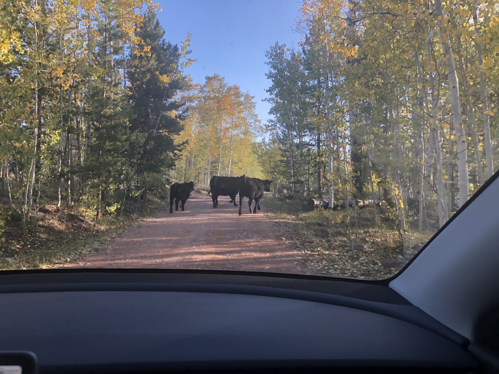
Soon we crossed into national forest land, and encountered cows along the side of the road.  It was pretty deserted, but we occasionally passed a pickup truck with a trailer off of the road.  I think people were camping there to hunt.  Then the road deteriorated to the point that the meadow alongside of us looked like a better route than the road;  and there were quite a few tire tracks through the meadow.  So we left the road and drove through the meadow, until the road became more passable.  Shortly after we returned to the road, there was a short section that was VERY rocky and went steeply up.  I was not sure we could make it up it, and less sure what we would find once we did make it up.  Rob got out and walked up to the top and decided we probably could make it up but wasn't sure what was yet to come.  So at this point, we decided to turn back.  

Rob was pretty annoyed (at me?) and was sure that we wouldn't be able to make the hike today, at all.  By my calculation, we would still make it to the trailhead by 10, and with an approximately 5 hour hike, I thought this was fine.  I was a bit worried about the car having enough charge to get us to the trailhead and then back to Evanston at the end of the trip.  We headed back and figured we would come up with a "rock bottom" charge for the car when we got to the correct turnoff (the one that Google recommends, and that the Forest Service recommends :P).  That turn puts you on a road that the forest service refers to as an "oil and gravel road".  I wasn't sure what that was, but it sounded better than driving through a meadow.  The road was bumpy and got bumpier but other than that, it was just fine.  We managed to get to the trailhead with a few percent more battery left than our rock bottom (and the last 30 minutes were uphill, so I figured the drive out would be easy) a few minutes before 10:00.  Phew.

Based on what I'd read, the route was somewhere between 9 and 12 miles (with 10 miles seeming most likely) with about 1500 ft of elevation gain.  But it starts at nearly 9000 feet, which I found difficult.  The trail is very well maintained.  There are many points where you have to walk across small streams or muddy areas, but they all had nice rock trails across them.  There were one or two crossings that I found tricky, but I am generally a very big wimp about balancing myself on rocks.  The first 8 o 8.5 miles slope up very gradually, at most 100 feet per mile, and then there is a one mile section of switchbacks where you probably cover like 500 feet.  The switchbacks were a bit exhausting (especially at that altitude and that far into the hike) but nicely maintained and overall very civilized :)   I found the hike to be very tiring (due to the altitude, I think) and my feet were killing me (I really need new hiking boots -- any serious hike results in a HUGE blister on one of my heels -- like 2 inches in diameter!) but I would not describe it as "hard".  But I did just want to get the hell out of my pack by the time we got to the lake :P  Rob's legs were destroyed about 6 or 7 miles in; I think his pack was too heavy due to his camera gear.  We probably should have load balanced better.  At some point I looked back and saw that Rob had acquired a walking stick.  It was a very nice-looking, sturdy stick.  I'm not sure Rob would have made it the rest of the hike without his stick to lean on :P

A lot of the hike was along a stream, and most of it was shady.  There seem to be differing opinions on the level of shade in the reviews that I've read.  There are sections out of the shade but they didn't seem to last longer than 5 or 10 minutes.  It was probably low 50s when we left and high 50s by the hottest part of the day, so the weather was perfect for being able to wear a lightweight long-sleeve shirt and not have to worry about sunburn.

Anyway, a couple of useful tips for the hike.  

- If you don't want to do the whole hike in in one day, there is an area about 7 miles in right near a bridge that goes over the stream (creek? river?) which has good access to water and lots of flat spots that look like good places to pitch a tent.  

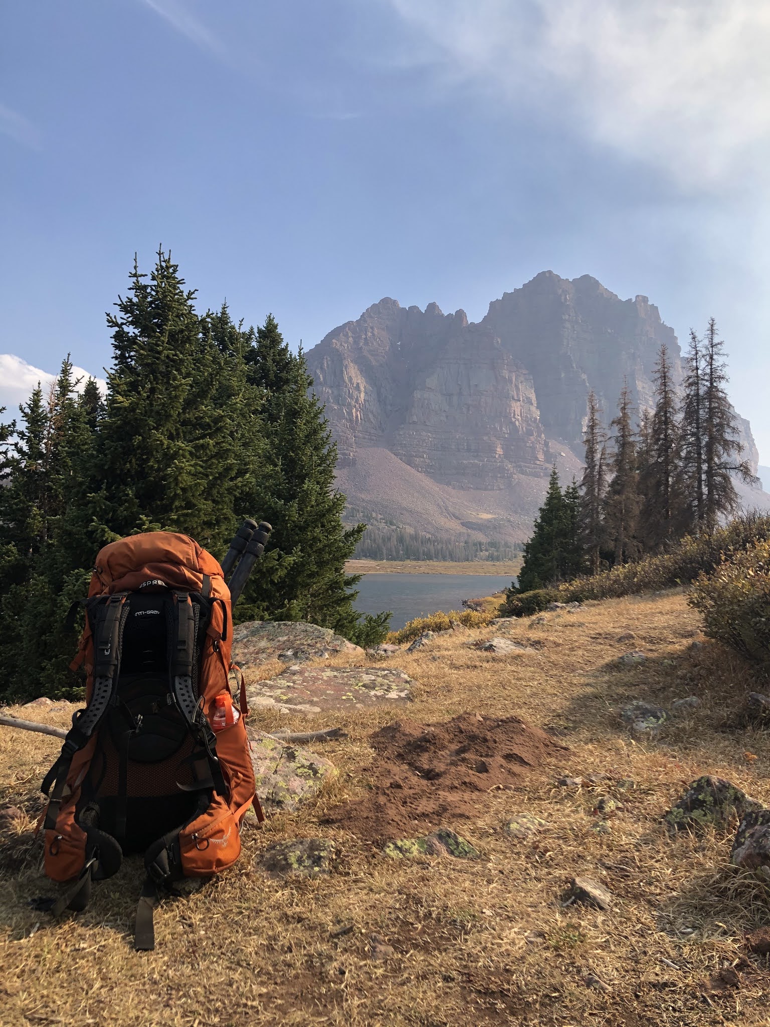
- A little before mile 10, we came to a fork in the trail, with a sign that pointed right to go to Lower Red Castle Lake, which we followed.  But going left is better.  From the path that we took, we could see the lake but couldn't see how to get over to it until we saw some tents and basically brute forced our way through a bunch of bushes to our left to get over to where we saw campers.  Those campers were very friendly and pointed us to a really good camp site.  After setting up camp and wandering around, we found the trail that we should have come in on (and that we hiked out on), which was the trail at the left of that fork.  If we had taken that route, it would have been another 0.75 miles and we would have been led right past some great camp sites.

- The total hike was around 10.5 miles, according to my Apple watch.  It took us about 6 hours, which included many stops for snacks and whining.

- We saw TONS of people hiking out on our way in.  But when we got to the lake, there were only 2 other groups (one near us, one far away) camping there.  I assume this is because we went up there on a Sunday and on the weekend it's more crowded.

We were both pretty destroyed when we got to the lake.  Rob claims we were "delirious" hehehe.  I mostly just wanted to get out of my damn boots (and pack).  So it was a very lazy evening, once we had our tent set up and had filtered water from the lake.  I managed to produce a pretty nice cheese plate to snack on (I was in charge of provisioning and I was quite excited about the manchego and salami that I had brought!).  Rob wanted to shoot sunset, so by the time we were making dinner, it was cold and getting dark.  We couldn't manage to get our water quite to boiling for dinner, so we had lukewarm, not quite rehydrated chicken and dumplings.  It was more like chicken and croutons, which was still tasty :)  In hindsight, due to our delirium and exhaustion, we did not really eat enough.

Our plan for the second day was to hike up to Red Castle Lake (we were staying at Lower Red Castle Lake).  Details were once again sketchy in terms of how far it was, but it seemed likely to be 2.5 to 3 miles away.  We were exhausted and weren't convinced we were actually going to do it.  We talked about just walking around our lake and laying around in the tent for the day :)  Then our neighbors (who had packed up and were about the leave) told us we should really go up to the next lake, that it was only like a mile and a half, and there were moose at sunset.  Those two facts changed our mind about going there.  As we were chatting, one of the guys looked at Rob's sweatshirt and said "you dove Cordell Bank?".  Turns out he was from the bay area, dives in Monterey, and was familiar with Cordell.  Small world.


Since we were having trouble getting super hot water (our oatmeal that morning was a bit lukewarm, but the coffee was just right), I mentioned to Rob that you can make ramen (or most dehydrated meals) with not-hot water, it just takes much longer, and obviously results in not-hot food.  We decided that not-hot ramen noodles might actually be good, so after breakfast, we put a pack of ramen noodles in our pot with not-hot water and figured we'd see what that produced by lunch time.

We went for a short walk down to the lake and around it (to the left).  We found the perfect little rock for two people to sit on at the edge of the water and hung out there for a while.  We debated whether the nearest camp site was a better camp site than ours, but we had some pretty good sitting rocks at our site, just not right on the lake.

When we returned to camp, we found that the ramen noodles had plumped up quite a bit and were delicious.  In fact, I think they are more delicious like that than as soup.  After lunch, we came up with a plan for hiking up to the other lake.  We figured we wanted to be there an hour before sunset, then we estimated how long it would take to get there, and then we added an hour, so we could walk as slowly as we wanted :)  This turned out to be a good idea, not just because we walked slowly, but also because the sun sort of set behind the "castle" rock before it was actually sunset.  So "an hour before sunset" is more like two hours before sunset.  This is good because it means you can have a cheese plate and walk slowly back down without worrying about hiking in the dark.

The hike up was indeed pretty easy.  There were some annoying sections where you are walking over ankle-turner rocks, and some small stream crossings, but there was nothing hard either technically or in terms of exertion.  It did seem like we were almost there for quite some time, and just when you think you are almost there, you come to a clearing that after walking across, you have to walk up a short steep section (though it's almost like walking up stairs, so not difficult, just tiring).  Then there is a long walk to actually get to the water.  I think it was around 2 miles.  But it's better that we thought it was 1.5 :)

On the way up, we were walking through a nice forested area (probably the nicest part of the walk) and I saw a moose in the forest!  It didn't have antlers, so that was a bit disappointing, but it was a moose!  Rob did not have time or the right lens to get a real picture, but we got a "proof of moose" picture.  I'd never seen a moose before, so that made the whole hike worth it!  Anyway, once at the lake, Rob was taking pictures for a while, so I took some pictures of him taking pictures.  Then when I got bored of that, I found a nice sitting rock, and made us a cheese plate.  It was a pretty awesome cheese plate for being 12.5 miles from civilization.  Well 12.5 miles from the car, civilization was way further than that.  After the sun had deposited itself behind the castle, we headed back down to camp.

On the second night, we were much more organized about dinner (okay, I was much more organized, and Rob followed orders).  We had dinner before Rob's evening photography plans kicked off.  I really wanted to have late night hot chocolate (and oreos) but didn't want to have to schlep back to our bear bag late at night.  So after dinner (rehydrated beef stroganoff, this time made with boiling hot water), we put boiling hot water in a thermos, hot chocolate powder in our mugs, and oreos in a bowl.  Then we packed up all of our trash and food and hung the bear bag.  Then after Rob's photo fun, we listened to a couple of podcasts in the tent and had hot chocolate and oreos.  And we just had to clean up our dishes before going to bed.  Rob set an alarm for 11 or 12 to do some photo things.  I didn't really know what he was doing, but he said it would only take 10 minutes to setup and then he would go back to bed.  So I got up with him so I could see the stars and milky way (which was very visible to the naked eye).  It was not nearly as cold as it had been the night before.  After Rob doinked with his camera for a bit, we went back to bed.

I woke up a couple hours later and heard something in the vestibule (where our backpacks were).  It sounded like something scratching at either the tent or our bags.  I'm sure it was some sort of rodent.  I listened for a while and then woke Rob up.  He tried to scare whatever it was away basically by punching at the side of the tent, and that seemed to work.  Not that much later, I woke up to what I thought was really bad wind.  It was very noisy in the tent (but perfectly warm).  Rob woke up and hopped up out of the tent and took off.  I wasn't sure why.  Then I figured he was worried about his camera blowing into the lake.  It seemed like he was gone for a while, and when he came back, he stuck his camera in the tent.  I asked if he was worried about the tripod blowing away.  Apparently it wasn't actually wind that I was hearing, but rain.  It had just started to rain, so the camera was okay.  Unfortunately the doinking Rob had done earlier in the evening was to setup a long exposure shot to start 3 hours later, and it had not quite made it to that time when he had to pull the camera inside.  After Rob got back into the tent, it started to really pour.  Or that's how it sounded in the tent.  It was not that wet the next morning, so perhaps the tent just magnified the sound.

The next morning, Rob took some early morning pictures, we had breakfast (reasonably hot oatmeal and coffee) and packed up to hike out.  The hike out was reasonably pleasant.  My toes were still killing me from the hike in, so that was kind of unpleasant, but well, it was all downhill, so there was a lot less complaining.  The hike out was not substantially faster than the hike in -- I think it took about 5 and a half hours.  We took a 5 minute break every hour for the first 3 hours.  Then my watch died, which meant that I could no longer pace our breaks and had to keep asking Rob for time/distance.  As you can possibly imagine, Rob was not too amused by that :P

I was quite delighted when I saw the car, because it meant that I could change into flip flops :)  We headed back to Evanston (with plenty of charge) and we were so hungry.  I had been thinking we would stop for lunch on the hike out, but we ended up just consuming all of our trail snacks (nuts, trail mix, dried mangoes).  Since we were in Wyoming, and we had encountered so many grazing cows, we decided we should find some steaks for dinner.  A bit of research revealed one supposedly good steak place in town, but we couldn't get a reservation until late enough in the evening that I surely would have gnawed my arm off before then.  So instead, we went to Cattle Company Steakhouse.  It's attached to a motel, and not a very impressive looking place, but the steaks were VERY tasty and so were the sweet potato fries.  They may have been the best sweet potato fries I've ever had.


Saturday, September 19, 2020

Road Trip: Evanston, WY

Waiting to charge
We had done a little bit of research on backup options if it was too smoky in Idaho, and based on that plus the weather/air quality forecast for the next few days, we decided to do a 3 day/2 night backpacking trip in the High Uinta Wilderness to Red Castle Lake.  We decided that the most reasonable place to stay the night before was beautiful Evanston, Wyoming.  There's a supercharger there and some reasonable hotels to stay at.  We stayed at the Hampton Inn, which quite conveniently has a super charger in its parking lot (though we didn't realize that when we picked it -- I picked it based on my perception of its price-performance).

Red monkey butt amber ale


We had a night to kill in Evanston, and after a bit of research, we decided to go to Suds Brothers Brewery.  If nothing else, it would give me a good opportunity to continue documenting our trip in Untappd (which I'd been doing a pretty good job of so far).  I gave the Red Monkey Butt Amber Ale a 3.5.  They had fried cheese curds on the menu; Rob was not familiar with the concept of cheese curds (except in poutine form), so we had to give those a try :)  A couple of other observations on our short time in Evanston -- there are a lot of big pickups everywhere that you go (I was jealous) and wearing masks didn't seem to be a thing that had spread to these parts.  When we walked into the restaurant, everyone was looking at us like we were aliens, and I think that is why.

When we got back to our hotel, we packed our backpacks.  Somehow, I ended up with a really light (but full) backpack after our first attempt, so we ended up trading a few puffy lightweight items (like my coat) for heavier items (cheese and sausage) to try to make up the difference.  Eventually I decided not to complain anymore about my pack being too light :)


Friday, September 18, 2020

Road Trip: Twin Falls to Sun Valley, ID

On Friday, our plan was to charge the car (and find some coffee), check out Shoshone Falls and the Snake River Canyon, then head to Sun Valley and stop at Craters of the Moon National Monument on the way there.  We drove over to the supercharger and realized it was in the same parking lot as the Twin Falls visitor center, which was overlooking the Snake River Canyon right next to the Perrine Bridge.  Convenient.  So we walked across the street to Starbucks and when we came back, we went over to look at the canyon and noticed people setting up on the little lawn next to us to BASE jump off of the bridge over the canyon.  I was a bit astonished that this was allowed.  But people would basically non-stop jumping off of the bridge.  According to its Wikipedia page, the bridge "may be the only man-made structure in the United States where BASE jumping is allowed year-round without a permit".  The lawn next to the bridge was like the Breakwater of BASE jumping :)

Shoshone Falls (we suck at selfies)
After watching a bunch of the jumpers, we decided to head over to Shoshone Falls.  You can drive right up to an overlook to see the falls, and then there's a path on the other side of the canyon that you can walk up (and up and up) to get a different/less crowded view.  It was a nice little meander.  We walked for less than a mile before turning back, so it's really not much of a commitment to go on the walk.  There are some pretty cool-looking houses at the top of the cliff, overlooking the falls.

Inferno Cone
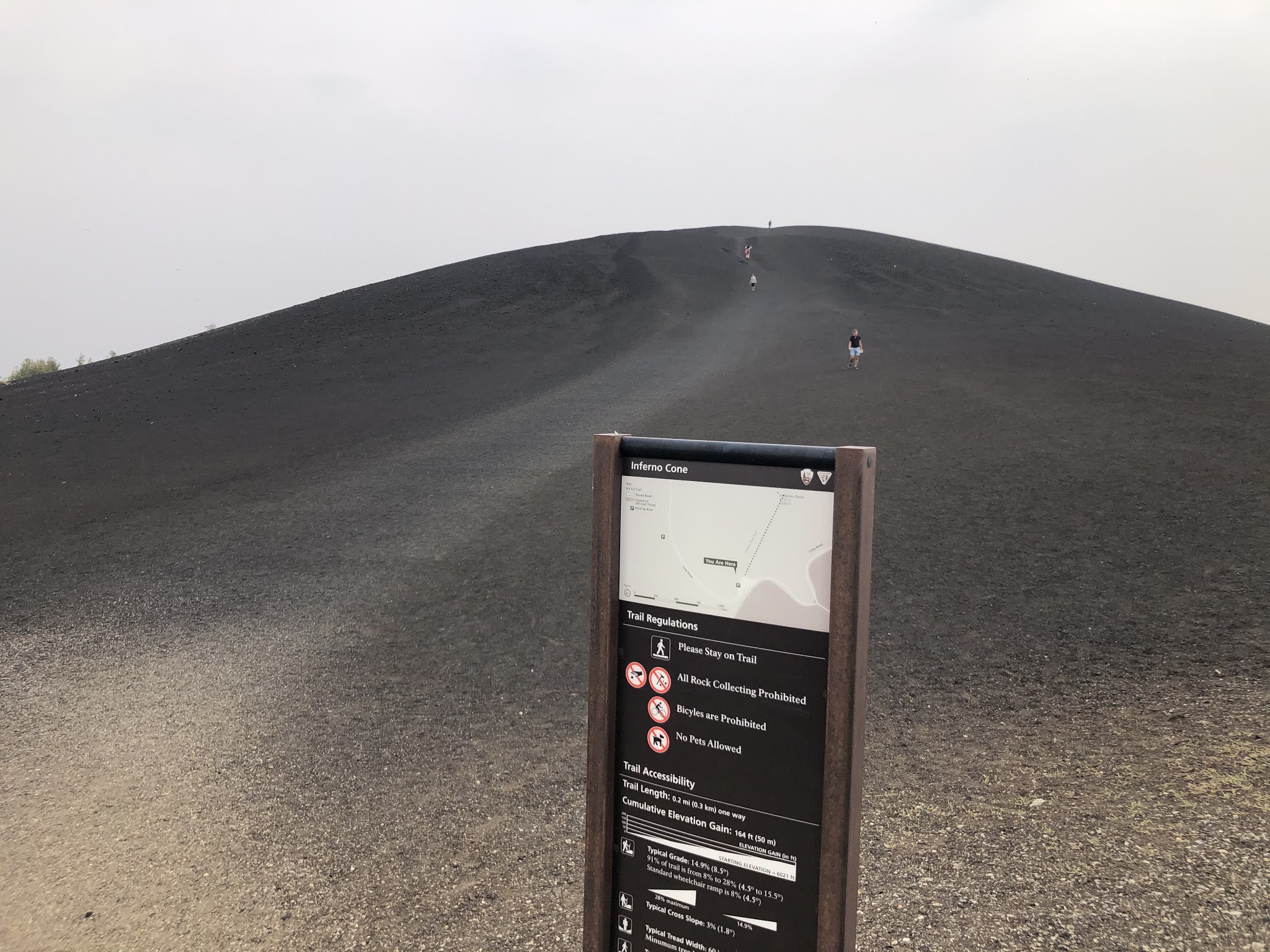
After that, we headed out of town toward Craters of the Moon.  I'm a bit divided on whether it was worth going there.  If you've seen lava fields before, I'm not really sure it's worth the drive.  On the other hand, if we had skipped it and gone straight to Sun Valley, I don't know if there would have been enough of the day to do much.  Craters of the Moon is a good stop if you want to drive around, get out of the car and walk around a little bit, then get back in the car and drive to the next point.  After the very uphill meander by the falls, it was a nice lazy afternoon.  We stopped in a few spots at Craters of the Moon to walk around.  I think the most interesting (and tiring) of the bunch was the Inferno Cone.  It's basically a huge volcanic ash sand dune that you can walk up.  Pretty neat.

Rob in Ketchum
When we got to Sun Valley, it was still very hazy out.  It didn't smell smoky like it had in Twin Falls, but the smoke was definitely impacting visibility.  We stayed in Sun Valley, which is outlandishly expensive, because they have Tesla destination chargers.  There's no public supercharger around here; this was the one part of the trip where charging was a pain.  (Even with the destination charger, it was a pretty big pain, since you have to happen upon the charger when no one is using it, and hope that someone doesn't leave their car plugged in all night even though it's finished charging.)

Pig whistles and poutine


We went to Ketchum for dinner.  Ketchum is a cute little town.  Even though it's a ski resort town, it feels like a real town and not a fake ski resort town (like Vail does, in my opinion).  We went to the Warfield Distillery and Brewery for dinner.  We sat on the roof deck, and hoped that it wouldn't start raining before we finished.  We shared Pig Whistles (most amazing snack ever), poutine, and brisket.  Everything was super tasty.  When we got back to the car, we noticed that the public EV charger right near where we parked was open, so we decided to plug in for a bit and go find a drink somewhere.  Finding a drink was harder than expected, because now it was 7pm on a Saturday night, and everything was busy.  

Ketchum Kolsch
We ended up back at Warfield, where we got more beer.  After killing time there for a while, we decided to get ice cream.  There was an ice cream hut that we'd passed on the way from where we parked -- Leroy's Ice Cream.  I got the Elk Tracks, because I can't pass up an ice cream flavor named after wild animals (e.g. Moose Tracks or Maine Black Bear at Cabot's).  Just as we were getting our ice cream, it finally started to rain, so we had to trot back to the car in the rain.  We ate our ice cream in the car while watching Netflix and waiting for a bit more charge.

It rained overnight, so in the morning, it was a bit less hazy out.  However, the forecast was for the air quality to get a lot worse over the next few days.  So we decided to do a hike near Sun Valley and then head to Utah for the rest of the trip.  After a bit of research, we settled on Taylor Canyon for the hike.  We did the loop counterclockwise, which I think was wise.  Much of the hike up was under tree cover, whereas the entire hike down was exposed.  Anyway, it was a nice reasonably short hike.  It was reasonably steep most of the way up and at the steepest part I think I was stopping for a break like every minute :P  But it was a nice trail and overall not very difficult.  When we got to the top, we took some pictures, even though Rob was sort of grumpy because it was still hazy.


On the way down, some sort of strange frozen precipitation started to fall on us.  It was 56 degrees and sunny when this started.  I thought it was hail at first, but when the little frozen balls landed on my shirt, I could squish them and they would collapse into a little pile of snow, like a tiny snowball.  After some extensive (okay not that extensive) internet sleuthing, I think that this was graupel, which I have literally never heard of before.  I'm still not convinced it's a real thing, since Blogger puts a squiggly red line under the word ;)  There was intermittent rain too on the way down, but it was just a few big drops for a minute and then it would stop for a while.  It was pretty refreshing considering we were totally exposed to the sun on the way down.

After the hike, we headed out of town, toward Utah. 

Thursday, September 17, 2020

Road Trip: The Drive to Twin Falls, Idaho

Birthday lunch
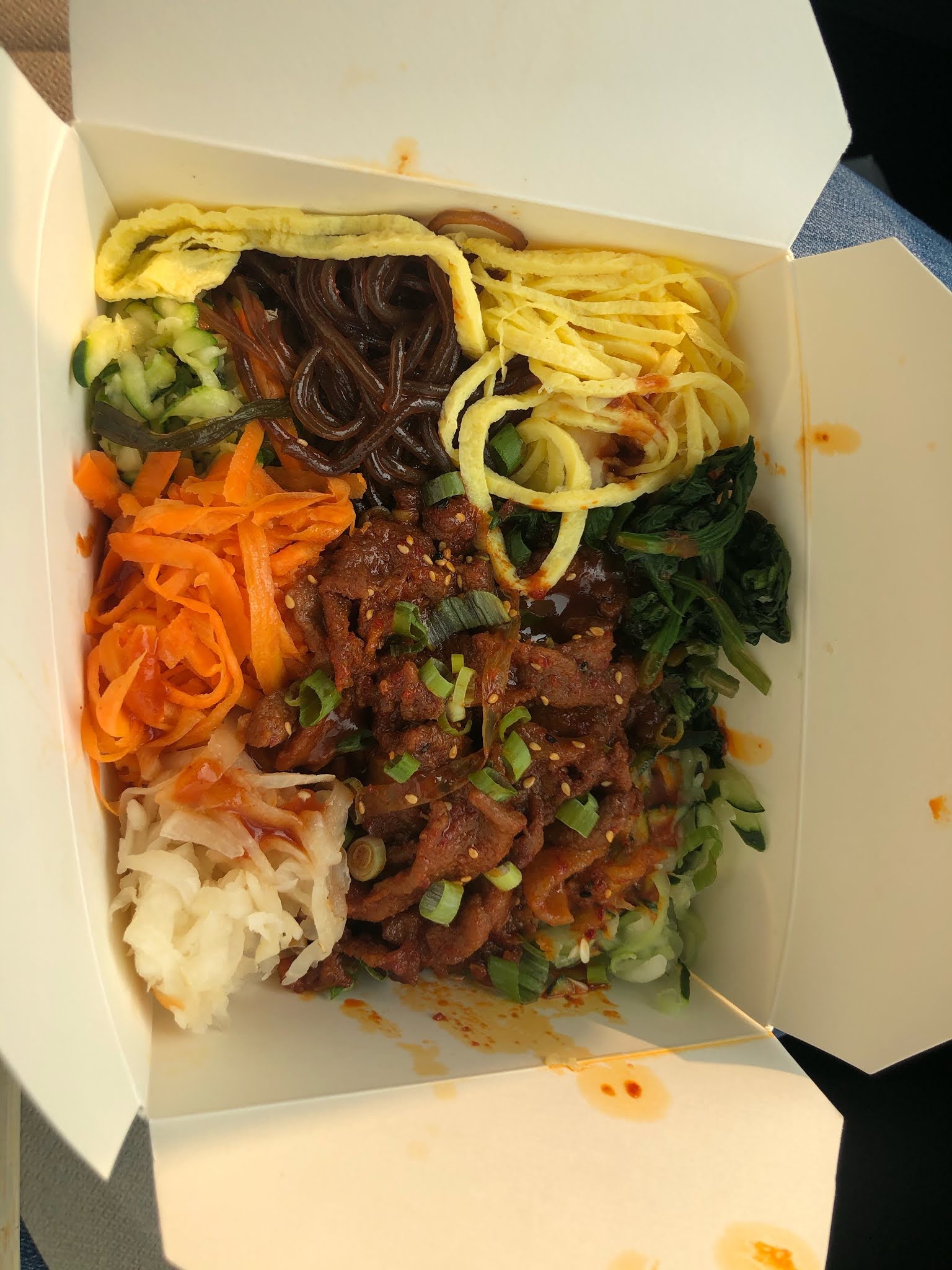
We left on Thursday morning, after my big "company event" which I had amazingly managed to survive un-hungover, and got going around 9AM, not sure if we were going to drive to Idaho or Utah :)  The air quality was terrible once we got to the Tahoe area.  It was also quite hot.  We stopped in Reno for our second charger stop and it was hot, humid, grey, and smelled like a camp fire.  The supercharger we used was a block from a fast food Korean place, so we walked over there and got some spicy pork bibimbap to eat in the car while we watched the West Wing (my favorite TV show of all time).  It was so tasty, just writing about it now is making me hungry.

On the topic of the West Wing... Rob gets pretty sleep when he has to drive long distances, so I thought that listening to some podcasts or books on tape might be a good way to keep him "engaged".  We were listening to an episode of 99% Invisible (one of the podcasts that Rob listens to), and I was googling around looking for some other good podcasts and I found something amazing -- the West Wing Weekly.  It's a podcast about the West Wing.  Each episode talks about an episode of the show.  One of the hosts is Joshua Malina, so they actually have access to interesting guests from the show.

Birthday dinner
Somewhere in the middle of Nevada, we started to seriously consider going to Utah.  Rob called a couple of his coworkers from Utah to get some advice on where to go if we wanted to go there.  But after waffling and staring at the air quality app on my phone, we decided to give Idaho a try.  We stopped in beautiful Elko, Nevada for our final charge stop and dinner at Mattie's Taphouse and Grill.  It was pretty decent for a restaurant in a random strip mall off of the interstate :P

After not too much longer of a drive, we got to Twin Falls, Idaho, where we were staying for the night (at the beautiful Twin Falls Fairfield Inn).


Sunday, June 7, 2020

More Pandemic Diving (and Pandemic Kitties)

During our couple of months of shore diving (sans Lobos), we did manage to dive a few places other than the Breakwater -- MacAbee, the Wharf, and Coral Street.  My one regret is that I didn't make it to Monastery.  Early on, there were a few weekends with 2 to 3 foot swell, and Rob did a couple of deep dives at North Monastery with Bobby.  But I'm not interested in diving Monastery in doubles or a rebreather these days, so I sat those out.  We looked at Monastery on at least three other dive days after that, and it was never diveable.  Sigh.

Nice viz at MacAbee
Okenia rosacea
Anyhoo, MacAbee was pretty good and we dived there at least three times.  There was pretty good viz on all dives.  But there were lots of cool nudibranchs on all of the dives.  I mentioned in my last post that Okenia rosacea and Limacia cockerelli were abundant in April/May, and this is where we first noticed it.  In the kelp forest, there were Okenias everywhere, and on the rocky areas outside of the kelp, there were Limacias everywhere.  The Limacias were weird (and I wonder if they are a different variety than what we usually see) in that they were quite large, and they had lots of orange blotches on the dorsum.  Aside from those guys, we saw a bunch of Phidiana hiltoni, (small) Triopha maculata, Acanthadoris hudsoni, and Acanthadoris lutea.  We saw all of these slugs on both of the first two dives... which makes for a pretty awesome slug dive when I list them all out.

Limacia cockerelli with splotchy dorsum
On one other dive there, we had heard there was SUPER clear viz in the bay, so Rob brought wide angle.  The viz was actually quite murky in most of the kelp forest -- so murky, in fact, that we got separated at one point and had to meet back up on the surface.  Okay it wasn't *that* murky, Rob just isn't a very good buddy and has a tendency to swim off after a long period stopped taking pictures, without any regard for whether his buddy is looking in his general direction and knows that he is swimming off.  Anyway, we eventually got to a very distinct change in the water, where the viz got SUPER clear and SUPER cold.  It was very weird, and it was quite unfortunate because all of the nice kelp was in the murky area.
Nothing to see here :(

I hadn't been to Coral Street in probably 10 years.  I always thought of it as the best kelp shore dive in Monterey (definitely the best in the bay).  Oh how things have changed.  The urchins have totally destroyed the kelp!  When you first swim out, it's like an urchin barren.  We eventually found some spindly pieces of kelp, but it's nothing like it used to be.  In fact, I would say it is not worth diving anymore.  MacAbee, Hidden Beach, and even the Breakwater have much nicer kelp these days.  Now that we are a bit further into the summer, there is reasonably thick kelp visible further off from the beach, but it is much further out than it used to be.

Janolus fuscus
Cuthona albocrusta
Last but not least, we dived the Wharf a couple of times.  There are some pretty cool slugs in residence these days.  We saw lots of Dirona pictas -- so many of them, we stopped pointing them out to each other, Janolus fuscus, an Ancula gibbosa (haven't seen one of those in ages!), and a teeny tiny white guy that I wasn't even sure was a slug until Rob got the shot, and it was a Cuthona albocrusta.  I also found a super cool tiny slug, which to my eye (which is not very good for something that size) looked like a teeny tiny sea hare; but Rob let it get away before he got the shot :(  I was starting to feel like I'd lost my slug-finding skills on that dive and then I found the Ancula, Cuthona, and mystery slug in rapid succession.  And of course there were tons and tons of the usual critters, like fringeheads and tiny octopus.

Dirona picta

All in all, some fun dives and some very good slug hunting.  It was actually pretty fun to do some single tank shore diving at sites I hadn't been to for a while.  Though after 10 weeks, it was definitely getting old :)

Felis catus, in a kitty pile
Speaking of getting old, in my last post, I promised some pics of the kitties having some fun in the sun in Monterey.  Or fun in the gloom might be more accurate ;)  Since our patio in Pacific Grove is completely fenced in, the kitties are allowed to go out there (as long as they are semi-supervised).  They've become totally spoiled and pretty much just expect outdoor time on a regular basis.  I don't know how that's going to work when/if we ever go home.
Oh, is this your chair?
Working on my tan

Sunday, May 31, 2020

The Breakwater, Six Ways

I'll take a break from writing about cuddly slugs to talk about some actual diving :)  In mid-March, when my office shutdown, I decided to relocate to our place in Pacific Grove for the duration of that shutdown.  So we packed up the kitties and a few other essentials (e.g. my InstantPot) and we've been down here ever since.  I'll post some pictures of the kitties enjoying outdoor time on the patio in a future post.

Anyhoo, since we've been down here, and boats and Lobos are shutdown, we've had to make do with shore diving, but we have managed to dive at least once a week this whole time.  Since we are lazy and not that creative, we've done a lot of dives at the Breakwater (aka San Carlos Beach) -- I think something like seven or eight dives.  Before this, I don't even know when I last did a daytime dive at Breakwater, but I'm guessing it was five to eight years ago (my last report on the blog is from 2011 though).  Not all of our dives were there, and I'll make another post about the other sites we've been diving, but more than half of our dives have been at Breakwater.  But that's okay, since there are a lot of different dives that you can do there.  So I thought I'd make a little post about what I consider to be the different dives of the Breakwater.  By my count, there are six, though one of them might be double counting.  Still, quite a bit of variety for one beach that can be dived in almost any conditions!  So, here goes, starting with the most common:

1. Breakwater Wall  

I think this is the most obvious and well-known dive, kind of the default dive to do at the Breakwater, unless you are with an open water class, kneeling in the sand.  The wall runs from about 15 feet down to 50 feet if you get far enough out, though in all honesty, when we go to just dive the wall, we never make it that far out.  That's because we would typically be doing a macro dive, and end up inching along the wall very slowly, looking for slugs and other tiny things.  During quarantine season, there were quite a few interesting critters that were out in abundance -- Okenia rosacea, Polycera atra, Limacia cockerelli, and a flatworm whose official name I don't know were extremely abundant.  On some dives, we were practically tripping over Okenia rosacea's.  Anyway, these weren't the only critters, but it was nice to have all of these all over the place, because they are all very pretty slugs, so we didn't have to look hard at all to find them!

So as I mentioned, I would normally consider this a macro dive, but there were a few days where the viz was outstanding at Breakwater, and a bit further out along the wall, there are some really nice patches of kelp.  So it might even be worth doing this as a wide angle dive, if the viz is right.  The trick to finding the nice kelp patches is to not follow the wall along the bottom.  If you stay a bit shallower in the 20 to 25 foot range, at least in recent times, the viz tends to be a bit better, and there are some nice patches of kelp that get nice sunbeams if it's sunny and the viz is clear.

2. Metridium Field

While this is a bit more of a swim, this is also a super common dive.  The way that we generally get out there is to enter on the far (north) side of the beach, swim out a ways, until you can line up the "building" at the end of the beach with the road (Reeside).  I'm not sure what this building is, but it's in the vicinity of where the bathrooms at this end of the beach are (but I don't think it's attached to them).  Once you drop, if you swim sort of northeast-ish, you will hit a big pipe, which you can follow out to the end, keep going in the north-ish direction and after two minutes or so, you should find rocks with metridium.  From there, you can hop from rock to rock or just swim anywhere in the north to northwest direction and you'll find more metridiums.

The pipe is in and of itself pretty interesting, especially if you are in it for the macro critters (though if you are swimming out to the Metridium Field, you are probably shooting wide).  We saw many of the same slugs/flatworms that were abundant on the wall on the pipe.  Fun fact: the first Hopkins' rose that I ever saw was on the underside of the pipe; I didn't know what it was called back then and dubbed it the bubble gum nudibranch.

A couple of random notes about Metridium Field navigation: first, you don't really have to do the lineup on the surface thing; you can really just drop wherever on that side of the beach, swim at 20 or 25 feet in that direction, and you will hit the pipe.  Second, on one of our quarantine dives to the Metridium Field, we decided to swim back over the sand, toward the wall.  We didn't exactly make it to the wall (and may have ended up in a gas sharing ascent from 30 feet :P).  I was pretty cranky because this just happened to be on a very windy day, and swimming in was kind of annoying.  But this reminded me of a dive that Kevin and I did together years ago, where we tried to do the same thing, and kept getting lost and having to surface to figure out what direction to go in.  But if your gas planning and navigation is better than ours, this is an option :)

3. The Sand by the Wall (recommended for a night dive) 

This is our default night dive (especially when we night dive with Clinton).  We just swim out along the breakwater until we don't feel like swimming anymore (I recommend dropping somewhere between the bathrooms and the next little building on the pier), drop there, and amble about over the sand.  We tend to see tons of tiny octopus, interesting sand slugs, like the shaggy mouse (Aeolidia papillosa) or maybe a Dirona picta, and the occasional super-cool little fish, like grunt or sailfin sculpins (okay, those really aren't common at all, but I have seen both on Breakwater night dives!).  We've also seen plenty of weird worms in the water column, and the occasional squid.  This dive can really be hit or miss -- some nights it's non-stop critter action and sometimes it seems like you see a lot of Hermissenda and one tiny octopus ;)  We usually just meander around in the sand until we get cold, and then swim back toward the beach until we hit sand dollars and surface there.

4. The Wall at Night.  

Okay maybe this is a double count.  But the wall is kind of a different dive at night.  There tends to be a lot more bigger rockfish around on the wall at night (versus the day), we've even seen bocaccio on a couple of night dives.  We also frequently see a harbor seal along the wall at night, using our dive lights to help it fish.  There was a resident harbor seal there for a while over the past couple years, and he was soooo friendly.  I would never touch the wild life ;) but I hear he likes to have his belly scratched.  The wall is also a good spot for seeing squid, and we've seen bat or torpedo rays here at night on a couple of occasions.  And of course all of the usual little macro critters are here at night too.

Sometimes we pair this with the sand night dive, and swim back in along the wall.

5.  Sea lions at the end of the wall

We finally did this dive during the shelter in place, twice!  We've been talking about doing this dive for ages, and it just never worked out.  We always thought it was more of a to do that in really is.  In fact, we always talked about scootering out to the end of the wall (thinking the scooters would get the sea lions riled up), but it's totally doable as a single tank kick dive.  It's a 20 to 25 minutes kick dive along the wall, and we kicked out around 20 feet most of the way, so you really don't use a lot of gas.  We came upon some sea lions maybe 15 minutes out, but don't be fooled, the best action is further out :)  The best action is also quite shallow, like 10 to 15 feet, though it's pretty good even at 20 feet.  This is obviously best done on a flat day, when there's not too much surge, and ideally when the viz is good (not that you can really predict that).  On the first day that we did this dive, the viz was really good.  It wasn't as good the second time, but we still had a lot of fun.

On both occasions, Rob briefly surfaced to see just how far we had made it out, and we were actually all the way at the end of the wall.  On one of the dives, there was a noticeable current near the end of the wall.  At some point on the way out, the kelp started leaning in the direction that we were swimming.  It was not a problem to swim back against it, and I have no idea if that is common, but worth watching out for.

On the second dive out there, I suggested we descend all the way to the bottom of the wall and swim back in along the wall; this was mainly because I was curious how deep the wall was at that point.  (Spoiler alert!)  It was 50 feet.  It was also dang cold and much murkier (which we'd experienced on other recent dives at the breakwater too).  Fun story not really related to the sea lions: at some point as we swam in from out there, Rob took off swimming hard, away from the wall, clearly following something.  So I followed him.  I had no idea what we were chasing; so I started to think about what we could be chasing.  A whale or a mola, perhaps? ... A shark?  At some point Rob stopped and signaled "shark".  I kind of freaked out.  Well not really freaked out, but I was like... that's it, back to the wall, we are going home!  I turned and started hauling ass back toward the wall.  Rob finally caught up with me when we got to the wall and explained it was *not* a white shark.  He showed me a not-great picture he had taken; it was definitely not a white shark.  Turns out it was a seven gill shark, which I am now very grumpy to have not seen!

6. Hidden Beach Reef

Okay, I made up that name.  But when we were getting tired of diving Breakwater, we decided we should check out Hidden Beach, which is the beach right next to Breakwater, by the Monterey Plaza Hotel.  So we went there one Saturday morning, and found that the stairs down to the beach were chained off.  This sort of made sense, since the hotel was closed and I think the stairs are their property.  So we gave up and dived the Breakwater instead.  Then the next week, on Friday afternoon, we happened to be near there (I think I was going to Otter Bay to pickup my new hood), and we saw that the stairs were unchained.  So we came back the next morning to dive, and the chain was up again.  Sigh.  So we decided to just dive the kelp patch off of this beach from the Metridium Field end of San Carlos Beach.  This is not that much of a swim, and honestly with the parking situation by the hotel and those stairs down to the beach, I think this might be a better way to dive the spot even if the chain hadn't been up!

We swam probably halfway to the kelp patch on the surface, then took a heading, dropped, and swam in that direction.  We found the kelp forest in not too long.  It was surprisingly shallow at least in the part that we visited, in the 20 to 30 foot range.  The viz just so happened to be quite good that day.  The kelp forest is really nice; it seems that the urchins haven't quite made it this far yet, compared to MacAbee where there are some spots that are urchin-free and some that are urchin barrens.  This might be my new favorite shore kelp dive in Monterey Bay!  (Though with the urchins, I guess it's sort of slim pickings.)  After about 30 minutes of frolicking in the kelp, we decided to head back.  We hit the pipe in the way in, and followed it out and visited the Metridium Field.  The viz was not nearly as good out there as it had been in the kelp.  Anyway, this was the day of our ill-fated (okay not really) attempt to swim back out over the sand from the Metridium Field.  We saw lots of dead/dying molas on the bottom :( and surfaced not quite back at the wall or beach :)

I think that covers all of the dives we've done at Breakwater in the last couple of months.  Have I missed any worthwhile spots?  Maybe the Barge...

Tuesday, May 26, 2020

Cuddly Slugs: Part 3

When I started this series, I had the best intention to post once a week, but then a squirrel ran by (I got distracted) and it was five months later. 🙀  Better late than never, though.

I am sad to report that I have no pictures of the slug that I made in 2012.  And I have no idea who won the slug, so I can't even hit that person up for a picture!  (So if you happen to have the slug, put me out of my misery and let me know!)  I've searched high and low in our network-attached storage device, email accounts, phones, and Facebook, and I can't find any pictures.  In the summer of 2013, my laptop was stolen (along with everything else of value in our house, which is luckily not that much), so I'm pretty sure that's why I have no photographic evidence.  For a while, I also couldn't even remember what slug I made.  And then I stumbled across some of the fabric that I used to make it, and I finally remembered it was a Doto amyra.  Dotty the Doto!
Photo by Robert Lee
Dotty the Doto component

(Don't worry, that will be the last sad story about a stuffed slug lost to history in this series.)

In 2013, after having two years to recover/forget how tricky it was to make the Spanish shawl, I decided to made another aeolid -- a Flabellina trilineata.  It really wasn't any easier the second time, and overall I don't think it was awesome as the original.  But the glowing lines that it's named for looked pretty nice.  John and Carol won the slug that year, and Carol was *really* excited to finally get one!
... the trilineata
Photo by Clinton Bauder
I think somewhere around this year, I stopped naming the slugs.  I just couldn't make a good name out of trilineata. (I don't think the Spanish shawl got a name either.)

In 2014, I was once again traumatized by the aeolid-making experience from the previous year, and decided to go a bit simpler.  (I was also probably hosed at work, which may have contributed to that decision.)  So I went with a Tochuina tetraquetra (which has since been renamed), which is a cool, pretty dorid.  I used beads and sequins to make the glowing tubercles, and ribbon for the fringe of gills that runs around the mantle.

Photo by Clinton Bauder
Photo by Dionna House :)

I also lost all photographic evidence of this slug, but luckily, who was the Dionna winner, took some pictures for me.  Thanks, Dionna!

That's it for today.  I promise the next installment will be in less than 5 months!